


Joshua Tree Traverse
- Rhianna Walzer
- Mar 6
- 7 min read

Updated: May 1
37 Miles on the California Riding and Hiking Trail Across Joshua Tree National Park
Quick Stats
January 10, 2025
6:40 am start time
California Riding and Hiking Trail: Black Rock to North Entrance
37.20 miles
3,481 ft of elevation gain
8 hours
GPX File
Trip Overview
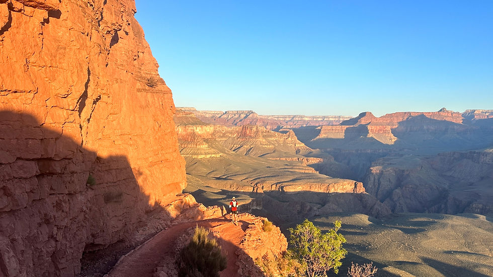
Joshua Tree National Park (J Tree) is one of the more unique parks in North America, home to unusual trees, cacti, and rock formations. J Tree draws visitors in for a variety of activities - hiking, biking, horseback riding, stargazing, and notably rock climbing. If you look out the car window driving Park Blvd you will likely see tiny colorful specs, climbers and ropes, on the rock formations.
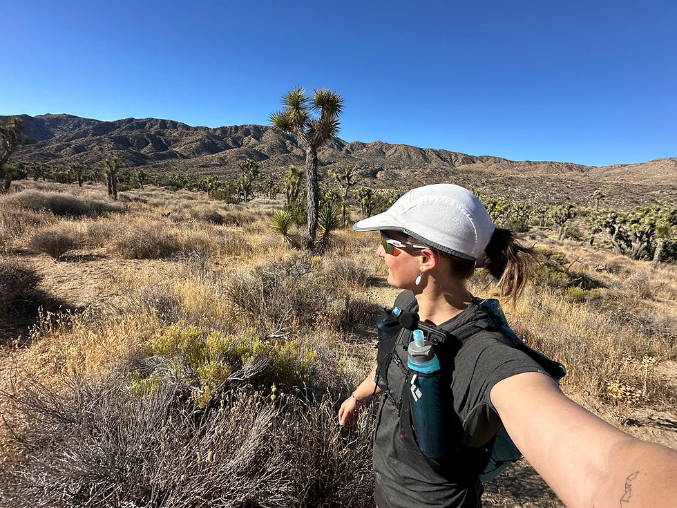
Jacob and I spend a handful of weeks in J Tree each winter to partake in the desert climbing craze. We set up camp at Hidden Valley and spend our afternoons placing gear and hand jamming. The park has a special place in my heart for trail running. I did a lot of training in J Tree early 2024 during my Rim to Rim to Rim prep (see R3 trip report). My favorite trail in the park begins at Black Rock Campground - Panorama Loop. I would run Panorama laps during long run sundays. I know that trail like the back of my hand. Black Rock Campground is also the starting terminus for the California Riding and Hiking Trail, an iconic 37 mile trail across the park. Trail running greats are all over the trail’s FKT page with blazing times. I wrote “Joshua Tree Traverse” down on my trail bucket list. I made it a goal to complete the trail solo and unsupported during our 2025 winter.
This would be my first large undertaking in the solo unsupported style. This style is exactly as it sounds. You need to be completely self-sufficient, carrying your own calories, water, and gear. The magnetic effect of this style is hard to put into words. For me, it is a highly empowering experience to rely solely on your physical and mental fortitude, backcountry knowledge, and problem solving skills. Enduring trail highs and lows alone is addicting. I crave the journey of being anxious, nervous, and fearful the night before and then proving those thoughts wrong upon completion of a challenging objective.
The J Tree Traverse is a fun solo unsupported challenge because there is absolutely no water on the trail. You have to carry all the water you need to make it 37 miles across the hot desert. I love a trail like this because it becomes a bit of a math problem - What is your time projection? How could the weather impact water consumption? How much water do you need to consume the proper amount of nutrition? How much extra should you carry, if any? What is your tolerance for dehydration risk? I love these questions. To answer them, you have to know yourself so well. You have to have prior experiences to gauge from. You have to do a risk assessment. This is part of the solo unsupported draw. It takes an acute self awareness to complete objectives in a safe and successful way.
So let’s get into the nitty gritty of the day and my answers to those questions.
Trip Report
We stayed the night not too far from Black Rock Campground, parked in the back of the Yucca Valley Welcome Center lot in our truck camper. I laid out my gear (see gear list) and tried to get a few hours of sleep, pushing away anxious thoughts of dehydration, rolled ankles, and mountain lions.
January 10, 2025. I got up around 5:30 am for my go-to big day breakfast of coffee, eggs on a bagel, and a clementine. We drove to the trailhead (see note on parking) as the morning sky was waking up, a perfect ombre of light pink to dark blue. That week, the weather in the park had been horrendous with classic J Tree winds in the 50+ mph range. But Friday, January 10, split the wind storm in half and was predicted to be a glorious day with a slight breeze and a high of 60. I took the perfect sunrise as confirmation of good weather.
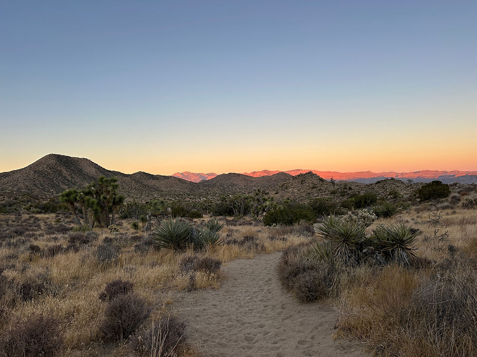
Knowing that this was intended to be a fun adventure and not fast, I made the decision to pack 5L of water (see note on water). I estimated it would take me between 9 and 10 hours to complete the trail. My water formula was 500mL per hour plus wiggle room. I filled 5L worth of water reservoirs, packed my bag, kissed Jacob goodbye, and touched the Black Rock trailhead sign, ready to start an epic solo adventure. The pre-sunrise ombre was gone, the desert hills now painted with morning alpenglow, and I was off.


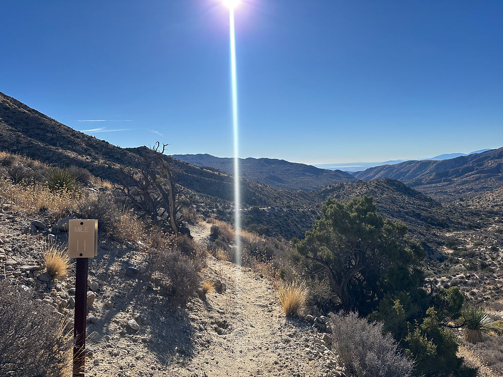
The J Tree Traverse has iconic mile markers. Steel posts count up the distance traveled. Sometimes the posts come fast, sometimes it feels like an hour passes before you see another one. The first 6 miles on the route are uphill, sandy, and the markers come slow. I walked a majority of those 6 miles to be more efficient and conserve energy moving in the soft sand. After 6 miles of sand slogging, I was rewarded with a perfect and flat single track, Joshua trees on each side cheering me on as I finally got to move fast.


Every two hours I stopped to refill my front soft flasks from the water stowed in the back of my pack. It’s a refuel ritual - take out front soft flasks, pour BPN G1M Sport endurance supplement into each flask, refill with water, and take out a new set of calories from the back of my pack to consume in the next two hours. On long slow days like this I aim to consume 150-200 calories per hour, focusing on high-carb snacks. As part of the refuel ritual I take out the yummiest sounding snacks that make up 300-400 calories.
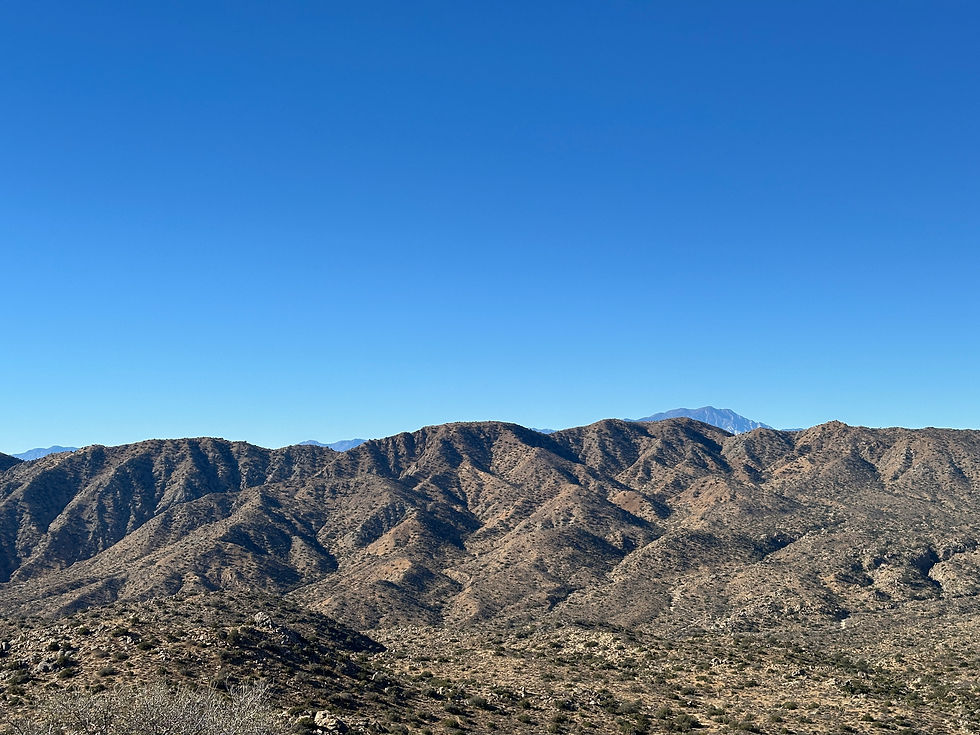
Miles 10 to 12 were the most beautiful of the day. The trail is downhill and almost ridge-like passing Quail Mountain. I giggled, smiled, and soaked in those 2 miles. They were perfect. But the bliss quickly changes as the next section is a 2 mile climb, the last of the big vertical pushes for the day. I crested over the climb and was rewarded with views of San Jacinto, San Bernardino, and San Gorgonio. Mile 14 marked the end of steep climbs and the rest of the trail is rolling and entirely runnable.


At mile 19 I was greeted by Ryan Campground. It’s the first sign of civilization since Black Rock Campground. I smiled seeing people climbing SW Corner on Headstone Rock. But solitude quickly returned, running past the campground, Ryan Mountain, and into an expansive desert landscape. Coyote paw prints and scat dotted the trail. The desert appeared to have no end. I was quickly reminded I was alone and had the second half of the trail ahead of me. Those next 10 miles were eerie.


Crossing Pinto Basin Rd at mile 29 marks the end of solitude. The final 8 miles run parallel to campgrounds, popular trails, and eventually Park Blvd. Cars and people teased that 8 miles stood between me and the finish line. At this point in the day, 8 miles felt like an eternity to go. I reminded myself that the downhill and sandy trail was something to be grateful for. How lucky the climbing is behind me and the final miles are speedy if my legs could endure.
With a mile left, I spotted our camper at the trailhead, a big smile on my face. My husband, dog, and a bubbly drink waited for me and my dirt soaked skin and terrible smelling clothes. I barreled to the trailhead, finishing strong like I always aim to do. I was so happy to see Jacob and Beta. I was so happy to see the iconic California Riding and Hiking Trail sign. I was so happy to stop my watch, sit down on a rock, and register that I completed the challenge fully self-sufficient.


Tips & Tricks!
Water
There is no water along the route. To go solo unsupported you need to carry your projected water needs. My formula was 500mL of water per hour. I conservatively projected a 9-10 hour finishing time with the intention of having a fun adventure and not moving fast. I packed 5L of water based on this formula. I finished in 8 hours and was 1L heavy which was a part of my risk assessment and conservative time projection.
Nutrition
I aimed to consume 150-200 calories per hour. I packed 2000 calories worth of Clif Nut Butter Bars, GoGo Squeez, That’s It fruit leather, Nerds Gummy Clusters, dates, and BPN G1M Sport endurance supplement. For BPN G1M Sport dosing, I am just shy of 1 scoop per 500mL of water (For me, a full scoop per 500mL of water is too powerful of a flavor). I packed 10 scoops based on my formula and consumed roughly 7 scoops.
Parking
This trail is point-to-point from Black Rock Campground to the park’s North Entrance. Both sides have a trailhead with parking. Black Rock Campground can be crowded on the weekend and parking does fill up by 10 am. For this trail, you will need a drop-off and pick-up crew or secure a ride from the North Entrance back to Black Rock Campground where a car is parked (45 minute drive).
Gear List
Kit
Garmin Fenix 7S Pro Watch
Black Diamond 15L Fast Pack
Salomon Bonatti Cross Wind Jacket
REI Swiftland Running T-Shirt
Patagonia Multi-Trails Shorts
Darn Tough Micro Crew Socks
Hoka Mafate Trail Runners
Running hat
Sunglasses
Emergency Pouch
Garmin inReach Mini 2
Black Diamond Deploy 325 Headlamp
First Aid Kit
Tylenol
Extra Sodium (LMNT or Salt Tabs)
Sunscreen
Aquaphor
Water
2 x 500mL Soft Flasks
4L water reservoirs
Nutrition
BPN G1M Sport (10 scoops)
SaltStick Chews
Kate's Real Food Bars
GoGo Squeez
That’s It fruit leather
Nerds Gummy Clusters
Dates

Not sure where to start on nutrition? Check out The RunnerBox®! Packed with go-to favorites picked by people who’ve been there, done that, and know what really works. Use code GETSTOKEDGIRLS to get your first box free when you purchase an annual subscription — get set for a year of fueling!


Comments